
Walk Penn Hills Township Street Records
The strongest Penn Hills Township address-record method follows the address, not a person name. First settle the road spelling with the township map. Then use the county property result as a parcel key, rather than treating its owner field as a household list. The parcel card supplies the bridge to the recorder, while the GIS view shows which boundaries actually adjoin the address. Each stage answers a narrower question and leaves an audit trail for the next one.
- Confirm the street spelling and nearby roads on the official Penn Hills street map. It is a current orientation tool, not a historical address-conversion record.
- Run the house number and street through the county address search. Save the parcel ID, physical situs address, municipality, sale clues, and book/page clue from the selected card.
- Open the parcel in GIS, pan to its exact edges, and click each adjoining polygon separately. Record the parcel identifiers instead of assuming a nearby home is an adjoining parcel.
- Use the parcel card's recording date, book/page, or party clue in the Recorder index. Compare the legal description, plan, lot, and block before tying a deed to the address.
- For election research, use the lawful county or state request route and its controlled categories. A street or walking list is not an open roster to copy or publish.
- For an earlier address, verify that a regional directory or map actually covers that Penn Hills Township street and year before treating it as evidence.
Note: Keep the parcel ID with each search date, because a similar street name, a parcel split, or a changed address can produce a false match.
Search Penn Hills Township Streets
The Allegheny County Real Estate Portal is the free starting point for a Penn Hills Township by-street query. Its Address tab is designed for an address or a stretch of one road, not for a free owner-name search. Put the road name in without its suffix. Municipality can narrow a street that crosses more than one local government, but it is optional. A known parcel ID can instead be entered on the Parcel Number tab. Owner-name access belongs to the county's subscription product, so an address or parcel search is the free route.
The county address-search screen shows the controls used to begin the parcel trail.
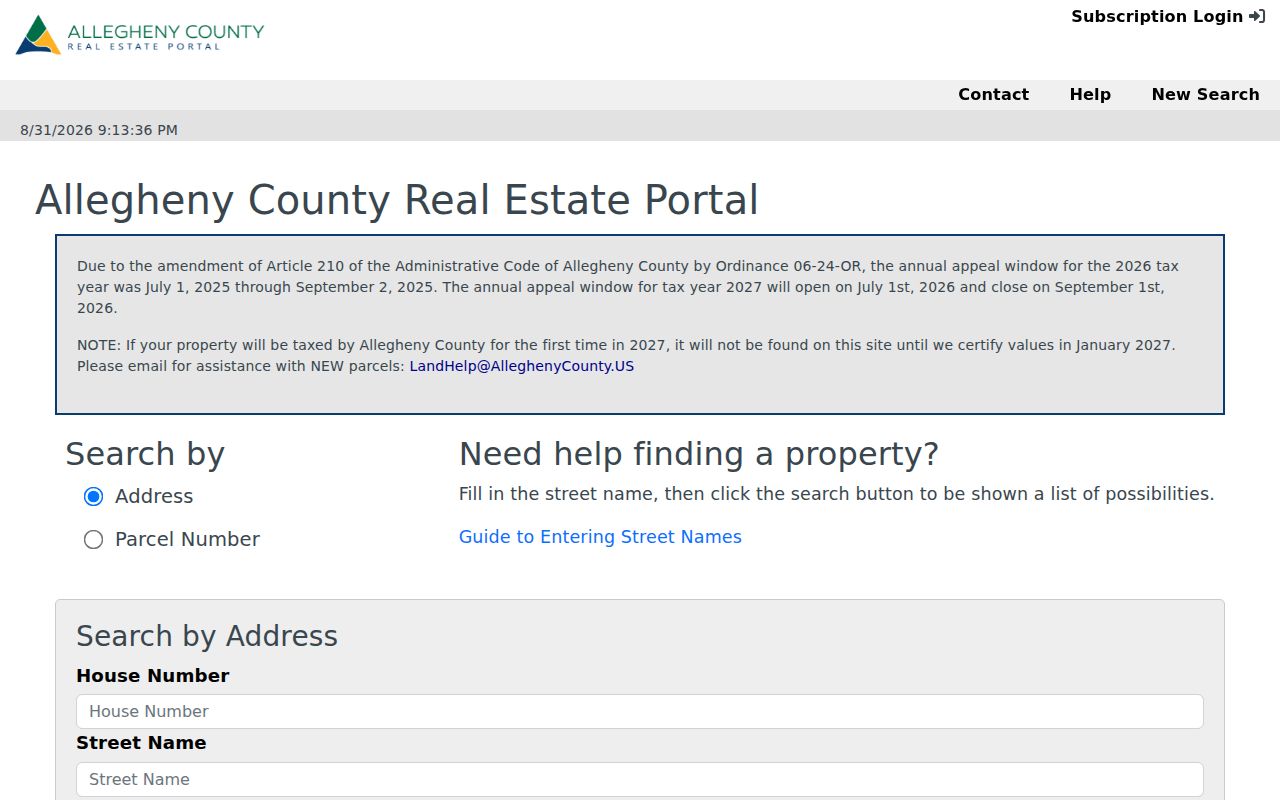
Use the result list to choose a parcel, then preserve its ID before moving to another record system.
| Search field | Requirement | How to use it |
|---|---|---|
| House Number | Optional | Add it when known to focus an address result. |
| Street Name | Required | Enter the name without a suffix such as Street, Drive, or Circle. |
| Municipality | Optional | Choose Penn Hills when it helps narrow a broad street search; remove it if results are too sparse. |
| Parcel Number | Alternative | Use the separate free parcel route when the parcel ID is already known. |
| Owner Name | Subscription only | It is not a free county property-search field. |
Penn Hills Township Street Directory Records
Address-keyed sources serve different roles in Penn Hills Township. The property card starts the current parcel trail. Recorded instruments date an ownership event. A map gives geometry, while a township file may document a specific administrative event if a responsive record exists. This coverage does not turn any one source into proof of occupancy.
| Address record | Keeper | What it can show | Access boundary |
|---|---|---|---|
| Parcel card | Allegheny County property assessment | Parcel ID, site and mailing fields, assessment, physical data, sale and book/page clues | Address and parcel search are free; owner-name search is subscription-only |
| Recorded deeds, mortgages, and plans | County Land Records | Parties, recording date, document type, legal description, book/page, and parcel linkage when present | Inspect the index, then confirm current image or copy access with the custodian |
| GIS parcel service | Allegheny County GIS | Parcel geometry, selected identifiers, layers, measurement, and map context | A mapping layer is not title proof |
| Permit or occupancy file | Penn Hills Code Enforcement | Procedure and responsive address file, if one exists | No online Penn Hills permit lookup was verified |
| Historic deed indices | State Archives and county land research | Grantor/grantee route into older books or microfilm | The documented Allegheny guide covers 1788 through 1904 |
A parcel is the fixed property identifier in this chain. An address result may display a road location, but the parcel ID is what carries the search from assessment to GIS and then to recorded land documents.
Read Penn Hills Township Parcel Cards
A Penn Hills Township parcel card can list an owner of record, a mailing address, and a situs address. The situs address is the physical location of the parcel. The mailing field is where the assessment office sends correspondence and can differ from that location. Neither field establishes every person who may be present at a property. The card also may provide tax and use codes, school district, homestead or other abatement indicators, recorded-sale clues, building fields, and separate history, image, comparable, appeal, and map tabs.
Building facts can help distinguish similar parcels. They may include rooms, style, stories, year built, condition, exterior, heating, garage, and living area. The tax area can show billed or paid status and payment dates. Those fields describe the property record, not a current household. The portal itself warns that Owner History is not a complete sale history, which is why a Penn Hills Township street directory search must hand off to recorded documents for chain work.
Note: A mailing address can be useful for reading the assessment record, yet it should never be relabeled as a current residence without separate support.
Trace Penn Hills Township Street Deeds
The Allegheny Recorder quick search accepts a broad term, recorded-date controls, preset periods, and an Index Only or Index & Full-Text OCR choice. Use it after the property card has supplied a clue, not as a way to guess an address chain. OCR can surface a lead, but the indexed fields and the recorded document must be compared before a conclusion is made.
The Recorder quick-index screen is the first recorded-document handoff.
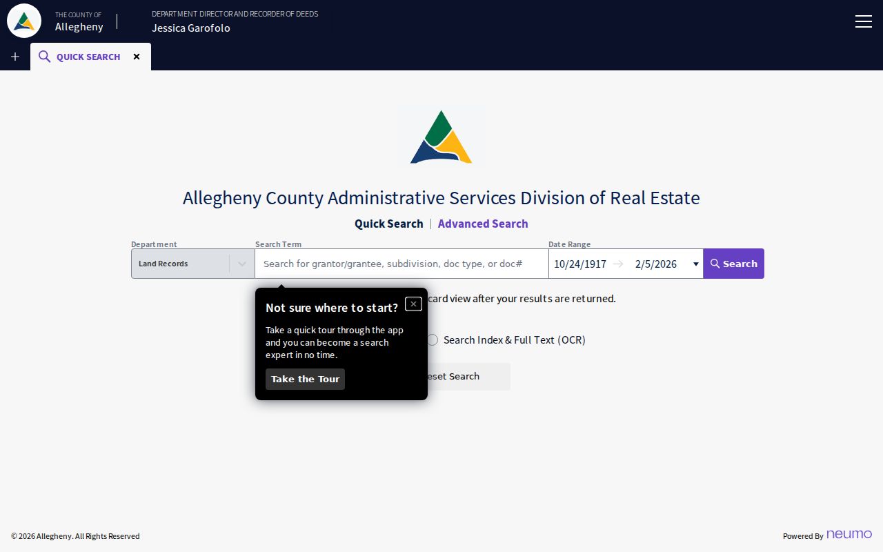
A date, party name, or book/page clue narrows the candidate instrument before it is read for the land description.
In Recorder advanced search, use grantor or grantee, date, document number, office, document type, book/page, OCR phrase, or parcel ID. The parcel field expects 14-17 digits without dashes. A grantor transfers an interest; a grantee receives it. Search the later seller as an earlier grantee only after the plan, lot, block, municipality, and legal description align. A mortgage, release, lien, plan, and deed are different document types, so not every hit marks a transfer.
The advanced Recorder form supplies the detailed fields for that comparison.
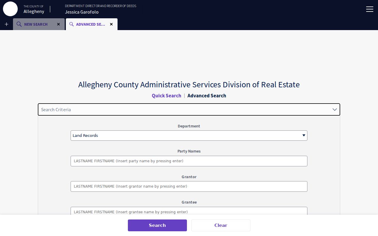
When the online index does not reach far enough, Land Records assistance and the State Archives' documented grantor/grantee microfilm route are the fallback path.
Map Penn Hills Township Street Parcels
The Allegheny County GIS viewer lets a Penn Hills Township street directory search move from a selected address to the block around it. Search the address, open the parcel information, pan and zoom to the shared boundary, then click each adjoining polygon one at a time. The viewer supports available layers, parcel information, measurement, basemap changes, printing, and address search. PIN and MAPBLOCKLOT identifiers may help bridge the map to other county work.
The county GIS service describes the mapping tools available for parcel review.
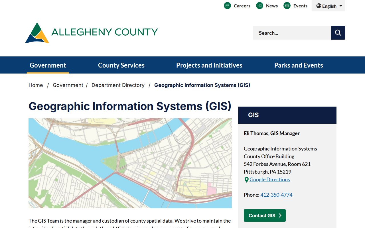
Measure distance only to understand the map. A GIS boundary shows adjacency, not title, occupancy, or a personal relationship.
Use the official township map for current road names and municipal context. No verified Penn Hills Township renumbering or criss-cross conversion run was found, so do not join old and current addresses by a similar street string alone.
Request Penn Hills Township Address Files
Penn Hills Code Enforcement is a request route, not an online permit-search system. The department handles code, zoning, building, grading, occupancy permits, and new construction, and its published material says building permits are not accepted online. Use a focused Penn Hills Right-to-Know request for an existing record: identify the address, a precise date range, the record type, and whether copies or inspection are wanted. Ask for records rather than an answer about who is at an address.
The building form contains location, zoning, subdivision, lot/block, work, owner, contractor, construction-cost, and permit-office fields. The occupancy material describes a permit for transfer and change-of-occupancy circumstances, plus a dye-test process with property location and lot/block fields. That procedural detail can date work or an administrative event. It cannot identify everyone associated with a home. The agency may redact protected information from any responsive file.
Note: A precise subject, timeframe, and record type give the township a workable request and avoid asking staff to create a new answer.
Keep Penn Hills Township Street Lists Controlled
Pennsylvania's voter-list request form distinguishes public-information, Street List, Walking List, and full-voter-file categories. A Street List can include name, residence or mailing address, party, and registration status. A Walking List has defined address, party, and status fields. The form requires requester information, identification, signature, and an acknowledgment of the applicable limits. These are controlled election records, not a public Penn Hills Township street directory to post online.
The personal voter-registration status route is for an individual's own status, not a block lookup. Election data should remain with the lawful custodian and its stated rules. It does not reveal a ballot choice, and its date should not be mistaken for proof of continuous residence.
Define Penn Hills Township Address Terms
Property records use several terms that matter when a Penn Hills Township street directory result is compared with a deed or historical map.
- Parcel
- The property-system identifier that connects assessment, GIS, and Recorder research.
- Situs address
- The physical location of the parcel on the assessment card.
- Plat
- A recorded plan or map that helps locate a subdivision, lot, or block.
- Criss-cross directory
- An address-arranged directory format that can provide historical context only where a specific edition covers the place and year.
- Legal description
- The land description in a recorded instrument, often using municipality, plan, lot/block, metes and bounds, or a prior deed reference.
Those fields are safer than a street name alone when a parcel was divided, a road name repeats, or a historical source uses an older form of an address.
Check Penn Hills Township Street History
For a past Penn Hills Township address, regional sources may add a dated layer but never substitute for a parcel match. Historic Pittsburgh's Hopkins maps cover the broader region from 1872 through 1940, and its city-directory collection has digitized years from 1837 through 1930 with gaps. Neither collection proves coverage of a particular Penn Hills Township street. Check the catalog, plate title, street, and edition first, then compare the lot or block with the legal description.
Historical directory work belongs with the documented collections on the Penn Hills Township Directory Book. No verified local reverse directory or universal street-renumbering crosswalk was located. That absence is a reason to preserve original plan and lot information before linking an old address to a current one.
Respect Penn Hills Township Street Limits
The boundary of a Penn Hills Township street directory is important. Property cards show a recorded owner and a mailing field, not all residents. Public sources reviewed here do not provide a street roll for other occupants, utility-account holders, delivery recipients, or motor-vehicle addresses. Court property fields appear only in relevant public cases, and protected or restricted court material is not an address-research shortcut. An address also may be protected through Pennsylvania's Address Confidentiality Program.
Lawful use. Use Penn Hills Township address records for personal, lawful research and record verification. Do not use them to stalk, harass, intimidate, or harm anyone.
A commercial neighbor-search category can combine stale or mismatched data. The recorded custodian, the record date, and the parcel's legal description are the better checks when an address fact matters.